Paddling the SAN FRANCISCO Bay
Paddling from Crane Cove Park
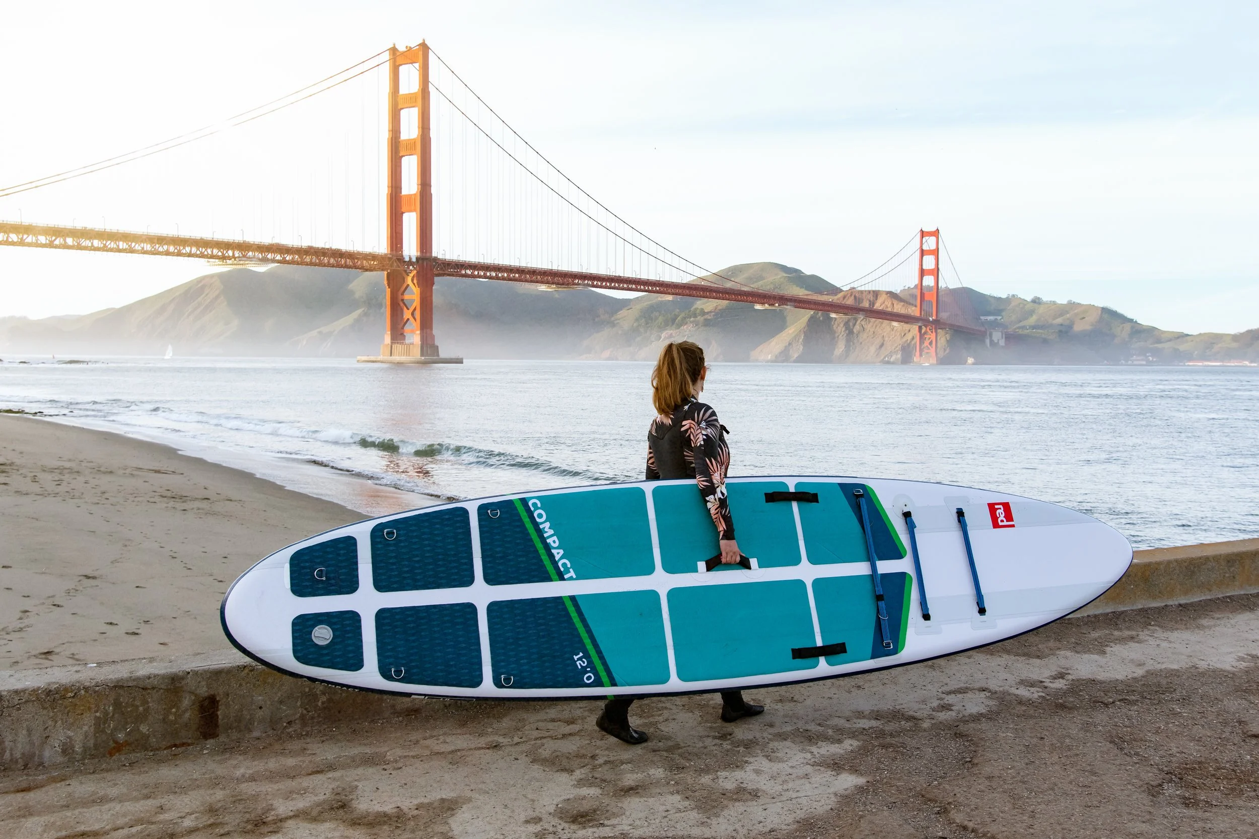
Crane Cove is one of the best launch spots in SF: protected water, easy access, skyline views, and wildlife sightings. If you’re new to the area, this page shows how to time tides, read wind, and choose routes—plus when it’s smarter to join a lesson or tour for hands-on coaching. Most of our operations currently depart from Crane Cove at this time.
Paddling from Mission Creek Boathouse
Mission Creek is an awesome put in for convenient access to McCovey Cove or the Bay Bridge. The calm waters of the creek also provide an excellent training ground for new paddlers who are not yet comfortable heading into the greater Bay. We currently offer limited services, by appointment, at our Boathouse, but will be ramping up regular weekends and Giants games in the Spring of 2026.
-
The currents in San Francisco Bay are legendary. Twice a day, Pacific water surges in under the Golden Gate, then drains back out—creating powerful flood/ebb flows that can overwhelm even strong paddlers. If you’re new to the Bay, nothing substitutes for hands-on instruction with our coaches.
Aim for slack. The best time to paddle is during slack tide—the brief window as the tide transitions, when current is at its lowest. As a rule of thumb, plan for about one hour before and after each high and low tide.
Hug the shoreline. Protected coves and inlets along the waterfront offer partial shelter from the main flow. We recommend stand-up paddlers and inexperienced kayakers stay close to the shoreline and piers and avoid open water when current builds.
Know your limits (and our map). Use our route map to see recommended zones. Do not pass the warning markersunless you are very confident you can handle the current now and on your return when the direction reverses.
Use a local tide app. Get familiar with a tide tool and set it to Potrero Point (our local reference). We like Tides Near Me for quick checks.
-
Always check conditions first. Use our 24/7 Crane Cove webcam (embedded below or open the dedicated page) to see what the water is doing in real time. If it looks rough on camera, don’t launch or stay in the most protected water.
Wind is the biggest factor. It can unsettle balance and make forward progress tough for both kayakers and stand-up paddlers.
Feather your paddle to cut resistance (turn the blade edge-on to the wind during recovery).
SUP: if wind builds, drop to your knees—or go prone—to lower your profile and stay stable.
Watch for “chop.” Wind creates a bumpy surface layer; when you see whitecaps (big or small) on the webcam, expect challenging conditions.
Pick “glassy” days to practice. Beginners should aim for calm, glassy water to work on stance, strokes, and turns before venturing farther.
Use a wind app. We check Windy.app—then confirm with the webcam right before heading out.
-
Being new to paddling in the area, you might find yourself just heading out into open water, in a straight line from Crane Cove Park, to try out your new gear. We see it all of the time. Our suggestion: don’t.
We’ve created a detailed paddle map of the area (screen cap below, click through to a larger version with details about each point of interest).
-
Crane Cove: Your safest place to practice is to just stay close to the cove. We take our little ones in summer camps around this protected cove, practicing figure eights, technique, and turns until we’re confident they are sure-footed. It’s generally the calmest part of the Bay.
-
These routes are designed for the moderate levels who are building their confidence and seek relatively safe and calm conditions to practice.
To Pier 54: The next level is to head out from Crane Cove Park, stick close to the shoreline at all times. Pass the San Francisco Boat Works over to Mission Rock Resort. Continue under or around the Agua Vista Park fishing Pier and hug the shoreline all the way to Pier 54. There are some minor hazards to watch for in front of Chase Center (we call the hazards / ruins the Roman Forum, because they sit in front of our modern-day Colosseum). Avoid paddling in the Roman Forum.
To Pier 52/50: Only on flat-water, slack tide, clear days. This can be a very easy passage or you can feel the force of the current depending on conditions. If you’re very new, don’t head past the edge of Pier 54 unless it is incredibly flat, glassy and there is no current pulling you in either direction. Then, turn sharply west and follow Pier 54 closely all the way in to Pier 52. You can hug the pier all the way around to reach the dock / boat launch for a rest or extraction.
Cape Hudson / Horn: If you want a thrill, head along close to Pier 50 until you reach the edge of the Pier and poke yourself out into the shadow of the massive war ships. We do not recommend beginner paddlers to get too close or pass too far beyond the edge of the pier. Peak it, take a photo and then trace your steps back to Crane Cove.
-
Once you are comfortable with your equipment and ability to control yourself, you might consider a bit more adventure. Remember to consult the above conditions resources before heading past the checkpoints on our map.
Mission Creek: Continuing from the above route, those with stronger skills and ambitions can make the foray over to the North Side of Pier 50. When passing the Cape Horn and Hudson you must exercise extreme caution as you are entering the channels where the force of the current increases significantly. Use tide charts to plan passage in either a slack tide or one that favors your direction. Once you pass the boats, head in towards McCovey Cove, pass under the 3rd and 4th Street bridges and then pass the houseboats to the Mission Creek dock. You can take a spur from McCovey Cove into the Southbeach Harbor if you’d like to visit some sea lions baking on the docks.
Pier 70: From Crane Cove Park, if you head straight out towards the dry dock (sticking north of the warning buoys) you’ll reach the edge that opens up out into the Bay. Again, here is a point of extreme caution where the currents increase in force and expose you to much greater challenge depending on the conditions. Plan for slack tide or current flowing in your direction in either way. Heading south, hug the pier past the dry dock and turn towards the shoreline. You can poke around the ruins on this side (being south, we call this Pompeii). Be careful at any tide, as there are many sunken, broken pilings that are waiting to puncture your craft. You can hug the shoreline all the way over to Warm Water Cove, past the Stack.
Islais Creek: If you have gumption and the conditions are right, you might consider continuing around Pier 80 and then heading into Islais Creek. There is a lot of ship traffic around here, so be cautious. Also, the tide and winds flow heavier in this creek so be prepared to paddle hard against unfavorable conditions. You can take a rest on the dock at Islais Creek (or even use that as an extraction point).
-
No swimming at Crane Cove (wading in the near-shore buoyed area only). Keep 300 feet away from piers and vessels. These are Port of SF rules for the beach.
PFDs: California requires a USCG-approved life jacket on board for every person; under 13 must wear onewhile underway. We recommend everyone wears a PFD on the Bay.
Give working vessels space. Tugs, ferries, and ships can’t maneuver like you can—cross behind them, not ahead; stay along the shoreline when unsure. (Harbor safety guidance.)
Emergencies
Use VHF Channel 16 or dial 911. USCG monitors Ch.16; Sector SF SAR desk is 415-399-3530 (phone backup).
Live Webcam of Crane Cove Park
Use this webcam to monitor the conditions at Crane Cove Park. You’re looking for wind in the trees, whitecaps on the water, and other paddlers out and about. Do not attempt to go out if conditions are not favorable.
Click to Expand Route Map
Click to View Tide Chart
Click to Expand Safety Information